 Title: The Family Tree Historical Maps Book of Europe: A Country-by-Country Atlas of European History 1700s-1900s
Author: Allison Dolan
Media: hardcover, 224 pages
Year: 2015
ISBN: 9781440342042
Item Code: BWY026
Price: AUD$49.95
Link to website
The “Family Tree Historical Maps Book of Europe” is an indispensable reference tool for European genealogy. Use this country-by-country atlas to put your ancestral origins in geographic context, unravel the European boundary changes that frequently trip up genealogists, brush up on key events in the history of your ancestors’ country, become familiar with its administrative divisions, and time travel across the continent!
Just telling you ABOUT this book doesn’t do it justice, so here a few pictures so you SEE how georgeous these maps are.
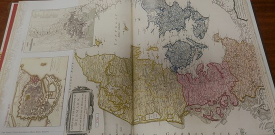
Denmark
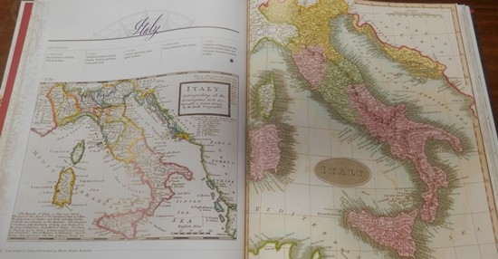
Italy
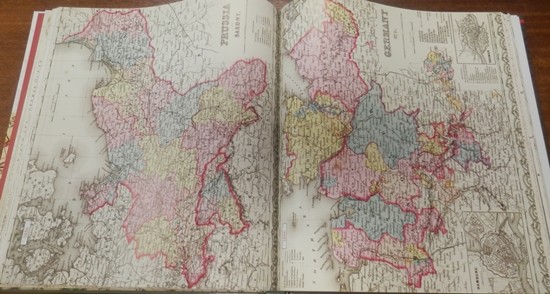
Germany and Prussia
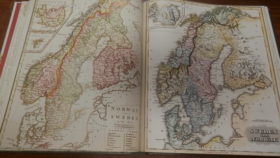
Norway and Sweden
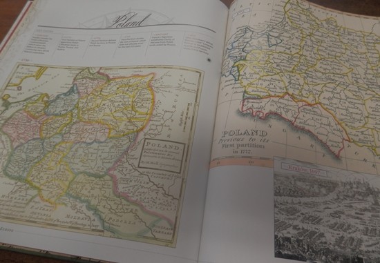
Poland
Beautiful aren’t they. Through the historical maps, this book shows the European continent and how national borders evolved during the 1700s, 1800s and early 1900s, when most genealogists’ European ancestors migrated.
Each country chapter gives timelines of important events in that country’s history, and contains numerous maps, all clearly dated, and showing key geographical units such as provinces, counties, regions, and cities.
The Appendix lists the administrative divisions by country for easy reference, which is an amazing work in inteself. This full-colour hardcover book is equally at home on your genealogy bookshelf or on your coffee table. It’s an excellent value compared to general hardcover reference atlases and, best of all, it’s designed especially for genealogists!
You’ll love this book if…
– You want to put your research of European ancestors in geographic context
– You want a reference to better understand European geography
– You need help sorting through border changes and locating where your family came from
– You enjoy looking at old maps
Contents:
Introduction
Europe maps and timeline
Ireland maps and timeline
Scotland maps and timeline
England and Wales maps and timeline
Spain and Portugal maps and timeline
France maps and timeline
Italy maps and timeline
Benelux maps and timeline: Belgium, Netherlands, Luxembourg
Scandinavia maps and timeline: Norway, Sweden, Finland, Denmark, Iceland
Germany and Switzerland maps and timeline
Austria and Hungary maps and timeline
Czech Republic and Slovakia maps and timeline
Romania and Bulgaria maps and timeline
Balkan States maps and timeline: Slovenia, Croatia, Serbia, Bosnia and Herzegovina, Albania
Greece maps and timeline
Poland maps and timeline
Russian Empire and Baltics maps and timeline: Belarus, Estonia, Latvia, Lithuania, Russia, Ukraine
Modern map of Europe
Appendix: Administrative Divisions (organized alphabetically by country)
Index of Maps

![Learn How To (and Why You Should) Cite Your Genealogical Sources [Highlight]](https://www.gouldgenealogy.com/wp-content/uploads/2019/02/THP049-cropped-440x264.jpg)


